Airspace Awareness for UAS Operations
uAvionix FlightLine is an aviation-grade Surveillance Data Service Provider (SDSP) designed specifically for enterprise UAS operators. It delivers comprehensive, real-time situational awareness of nearby airspace traffic by harnessing uAvionix’s extensive network of ground-based dual-frequency ADS-B receivers, combined with scalable cloud infrastructure for efficient processing and display of target aircraft data.
This robust solution empowers UAS operators, UAS Service Suppliers (USS’s), and broader Unmanned Traffic Management (UTM) platforms with reliable, low-latency surveillance, enabling safer, more scalable Beyond Visual Line of Sight operations and supporting the industry’s growth in advanced airspace integration.
Why FlightLine
Customizable to your needs
FlightLine is easy to customize to your enterprise’s operational needs. By simply selecting a custom geographic polygon, users can enjoy low-latency ADS-B traffic data immediately, either inside our ‘FlightLine Portal UI’, or via CAT021 API feed into your choice of visualization. FlightLine traffic API is already fully integrated with UI solutions such as AirspaceLink AirHub, Aloft, Motorola CAPE, OneSky, Votix and a growing list of industry-leading UAS visualization and UTM solutions.
Enhanced Operational Efficiency & Safety
-
Real-time detection and visualization of cooperative crewed and uncrewed aircraft along corridor routes or operational areas
-
Seamless integration with UTM systems and enterprise dashboards for centralized traffic data
-
Supports airspace deconfliction for BVLOS missions with consistent data proven to pass the FAA Safety case
Trusted by Regulators & Utility Operators
-
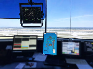
FlightLine is used by the FAA’s Surface Awareness Initiative (SAI) and Airborne Position Reference Tools (APRT)
-
Dual-band ADS-B reception, sensor health monitoring and API’s for data integration designed to fit your unique systems and operations
-
Reduces regulatory burdens and speeds your process toward approved BVLOS flights
How FlightLine Works
FlightLine for UAS operations delivers real-time ADS-B aircraft traffic data directly to UAS operators when and where they need it, leveraging uAvionix’s network of proprietary ground based receivers.
-
Receive ADS‑B Traffic Data from aircraft and UAS transmitting on 978 or 1090 MHz alongside data from 3rd party connected surveillance and flight systems
-
Access data securely via cloud data de-duplication and APIs for post-processing
-
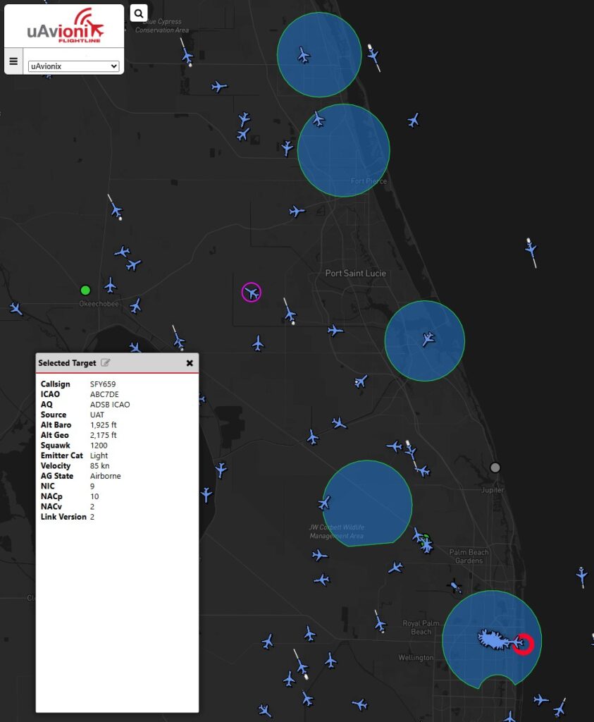
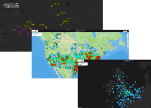
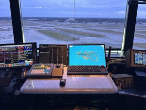
Display traffic overlays on uAvionix FlightLine Portal or via API in UTM’s, UAS ops dashboards, or ops center screens
-
Enables conflict detection and proactive alerts for UAS corridor, utility inspections and enterprise UAS operations
| Component | Description |
|---|---|
| uAvionix ADS-B Receivers | Dual-frequency (1090 MHz and 978 MHz UAT) ADS-B receivers with primary coverage in the United States and Northern Europe |
| FlightLine Portal | Real-time visualization of ADS-B and external source data. API integration available for enterprise dashboards or UTM platforms |
| Vehicle / UAS Transmitters | Compatible with data feeds from VTU‑20 for ground vehicles and uAvionix Trakr for UAS, enabling full situational awareness |
FlightLine Components for UAS Operations
FlightLine for UAS is a fully hosted and maintained data-as-a-service, providing scalable and reliable for capability enterprise UAS operations. The services includes turnkey sensors, API access, deployment, training, and ongoing support.
FAQ's
Ready to get started with FlighLine? Have a few more questions?
What is FlightLine and how does it support UAS operations?
FlightLine is low-latency ADS-B traffic feed, powered by uAvionix FlightStation ground receivers, and used by UAS operators to ensure situational awareness and deconfliction of crewed aviation from UAS operations in order to safely carry out BVLOS missions.
How does FlightLine integrate with UTM or enterprise command platforms?
FlightLine connects via a scalable cloud backend and open APIs, allowing seamless integration into UTM (Uncrewed Traffic Management) systems or your organization’s custom systems or dashboards. Once FlightLine traffic is embedded in 3rd party UI’s, it allows operators to have true situational awareness of their UAS with regards to all nearby crewed aviation.
What is the process to enjoy FlightLine ADS-B data?
Accessing FlightLine is straightforward and tailored to enterprise UAS operators, USS providers, and UTM platforms.
- Contact a uAvionix Sales Representative
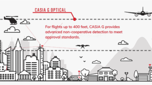
Reach out to the uAvionix team (via sales@uavionix.com, the contact form on uavionix.com, or your existing account manager) to discuss your operational needs, including airspace coverage requirements, integration preferences (API or portal), and any additional features like non-cooperative detection via CASIA G. - Define Your Coverage Area
Work with your representative to specify the geographic area of interest (typically a custom rectangle on a map that aligns with your UAS operations). This ensures you receive focused, low-latency ADS-B traffic data from the nearest uAvionix FlightStation ground receivers. - Activate Your Dedicated Feed
Once the area is finalized and the service agreement is in place, uAvionix activates your client-specific feed. Data is sourced from uAvionix’s nationwide (and expanding) network of dual-frequency ADS-B receivers, processed in the cloud for de-duplication, and delivered with high reliability and minimal latency. - Access and Integrate the Data
-View real-time traffic directly in the secure FlightLine Portal UI for easy-to-access situational awareness.
-Or, integrate via UDP API (CAT021 format) into your preferred visualization tools, UTM platform, or USS system (FlightLine is already integrated with leading solutions such as AirspaceLink AirHub, Aloft Air Boss, Motorola CAPE, OneSky, VOTIX, and more).
This flexibility supports seamless incorporation into dashboards, detect-and-avoid systems, or fleet management software.
The entire setup is fully hosted and managed as a turnkey data-as-a-service, including support and ongoing maintenance, no hardware installation required on your end. This process enables rapid onboarding and scalable, safety-case-ready surveillance for advanced BVLOS and airspace integration operations.
For more details or to get started contact the uAvionix team directly
Is uAvionix FlightLine only for airports?
No, FlightLine is not limited to airport use. While it powers key FAA initiatives, including the Surface Awareness Initiative (SAI) at numerous U.S. air traffic control towers and the Airborne Position Reference Tool (APRT) for enhanced airborne traffic awareness in contract towers, its core technology is highly versatile.
The same low-latency, aviation-grade ADS-B surveillance feed delivers reliable, real-time situational awareness for enterprise UAS operators conducting BVLOS operations. This shared emphasis on detecting low-altitude traffic with minimal delay supports critical safety requirements across applications, from airport surface monitoring to drone corridors, utility inspections, emergency response, and large-scale unmanned fleets.
Whether integrated into UTM platforms, USS systems, or dedicated UAS dashboards, FlightLine provides the validated, high-integrity data needed to safely integrate crewed and uncrewed aircraft in shared airspace.
How long does it take to deploy FlightLine?
For enterprise UAS operators accessing FlightLine as a cloud-based ADS-B Surveillance Data Service Provider (SDSP), deployment is remarkably fast. Most data feeds are activated and fully operational within 48 hours after finalizing your coverage area and service agreement.
Here’s why it’s so quick:
- uAvionix maintains a robust, nationwide (and expanding) network of dual-frequency FlightStation™ ground-based ADS-B receivers, no new hardware installation is required on your end.
- Once you define your operational polygon or rectangle with a uAvionix sales representative, the team provisions your dedicated, client-specific feed from existing nearby sensors.
- Data processing and delivery (via secure portal UI or CAT021 API) happen in the scalable cloud infrastructure.
In the rare case where sensor coverage is insufficient in your specific region (e.g., remote or emerging UAS corridors), the uAvionix team can assess and plan targeted expansions, such as deploying additional receivers. This may extend the timeline slightly while ensuring reliable, low-latency surveillance, but even these scenarios prioritize speed to support your BVLOS safety case.
This turnkey, hosted approach minimizes delays, enabling rapid onboarding for missions like utility inspections, emergency response, drone corridors, or large-scale fleet operations.
What are the benefits for UAS operators using FlightLine?
uAvionix FlightLine delivers aviation-grade, low-latency ADS-B surveillance as a turnkey SDSP, empowering enterprise UAS operators, USS providers, and UTM platforms with the reliable data needed for safer, more efficient, and scalable operations, especially BVLOS missions.
Key benefits include:
- Real-time tracking of cooperative air traffic
- Superior situational awareness for BVLOS missions
- Enhanced coordination of air and ground operations
- Strong regulatory and safety-case support for integrated airspace operations
- Lower risk of mid-air or surface conflicts in shared corridors
- Rapid, scalable deployment
- Proven reliability and flexibility
By providing the dependable, safety-case-ready surveillance backbone trusted by regulators and industry leaders, FlightLine helps UAS operators unlock the full potential of BVLOS at scale while prioritizing safety and airspace integration.
uAvionix Completes FAA Air Traffic Control Tower Deployments in Record Time at Six Florida Airports

uAvionix Accelerates FAA Surface Awareness Initiative with Rapid Deployment of FlightLine Capability
uAvionix and Capital Sciences Deliver First Surface Situational Awareness Systems for Major U.S. Airports